The use of helmet in alpinism

The use of helmet in alpinism

"The helmet, our great friend in the mountains"


Why do alpinists and climbers worldwide use helmets? Because of the risk of rock fall(caída de piedras in Spanish, chute de pierres in French, Steinschlag in German).


One of the major hazards of alpinism is the fall of rocks, be it individually or in small avalanches. The stones fall at the speed of a missile; it is frightening to hear them pass by.


The fall is usually caused by the warming sun setting loose stones which were previously stuck to the mountain by ice. It can occasionally also be triggered by fellow climbers.


How can we be safer up in the mountain?


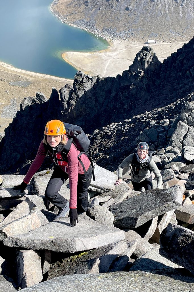
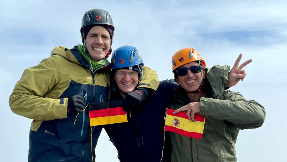
1) Use of a helmet is mandatory. Your chances of survival are exponentially higher. Even if you are hit by a rock, most chances are that you will only be stunned, not injured.


2) Get off the mountain as early as possible, before the midday sun has warmed the upper slopes of the mountain.


3) Use a descent route that gets you out of the foreseeable rock fall path.


4) If regular rock fall is already happening, as it is the case in Mont Blanc’s Grand Couloir, position one of the climbers as a lookout, while the others descend. When a falling rock is seen or heard, he or she will cry out: “rock fall, hit the ground !!!!”, and the mates will immediate jump to the facedown position.


Pachi Navajas, Director, AdvenCulture


AdvenCulture is a company specialized in Mountaineering, Culture and Leadership. We organize expeditions in Mexico, the Alps, the Andes, the Caucasus and other wonderful places on the planet.

Secrets for Elbrus

Success factor in climbing a five-thousander


In August 2016 we led an expedition to Mount Elbrus, 5,642m, situated in the Caucasus, and considered Europe’s tallest peak.


This mountain is only six meters taller than Pico de Orizaba, and is of similar degree of difficulty. Therefore, the tips offered in this blog apply to the Mexican volcanoes above 5,000 meters.


These were the factors that made our AdvenCulture-led climb successful:


-We devoted five full days to achieving the best acclimatization possible. We started with a simple trek to 3,000 meters, and gradually increased our altitude to 4,300, 4,700, etc.


-We took two full days of rest before the summit push. We make a point of going to bed early the previous night (we were lying down at 18h!).


-We checked the weather forecast closely, and chose a day with almost no wind and mild temperatures for our summit push (the lowest was -10 Centigrade).


-We drank and ate at every stop on the glacier. We made short pauses, so that we would not get too cold.


-During the descent, we took advantage of favorable terrain to slide down from 5,100 to 4,700 meters, thus saving considerable time and energy.


The result was great: all three German customers made it to the summit of Europe, and returned safely from our South Face climb.


Wir haben es geschaft!!!

The normal route of the Mont Blanc

The ideal ascent to Mont Blanc entails using the huts of Tête Rousse and Le Goûter. This plan allows us to split the effort in three days, to have a good degree of acclimatization, and to enjoy the wonderful landscapes of the Alps. Furthermore, you avoid having to carry heavy loads, because the huts offer anything you may need for food or hidration (they sell wine and beer, too!!!)


To get to Tête Rousse you have to take the Tramway du Mont Blanc, the oldest cogwheel train in the Alps. You can board it at Saint Gervais, or take it at the Bellevue station, in which case you will take a cable car from Les Houches.


The train stops at the Eagle’s Nest, the terminus, at 2,372 meters. You then walk on easy terrain to Tête Rousse, which stands at 3,200 meters. It will take you between two and three hours. It is an excellent hut, with a nice restaurant y comfortable beds.


The ideal ascent to Mont Blanc entails using the huts of Tête Rousse and Le Goûter. This plan allows us to split the effort in three days, to have a good degree of acclimatization, and to enjoy the wonderful landscapes of the Alps. Furthermore, you avoid having to carry heavy loads, because the huts offer anything you may need for food or hidration (they sell wine and beer, too!!!)


To get to Tête Rousse you have to take the Tramway du Mont Blanc, the oldest cogwheel train in the Alps. You can board it at Saint Gervais, or take it at the Bellevue station, in which case you will take a cable car from Les Houches. The train stops at the Eagle’s Nest, the terminus, at 2,372 meters. You then walk on easy terrain to Tête Rousse, which stands at 3,200 meters. It will take you between two and three hours. It is an excellent hut, with a nice restaurant y comfortable beds.


The second day begins with the traverse of the infamous Grand Coloir, also known as the “Bowling Alley” (guess what, we are the bowls!!!). This couloir is exposed to rock fall, and several accidents happen here every year. The earlier you cross it, the safer you will be. We then climb up a beautiful wall to the Le Goûter hut, at about 4,000 meters. The technical sections are equipped with a thick cable, acting as a fixed rope. You should have your harness on, as well as a life line. We recommend wearing thin gloves, as the cable is torn in some places, and could easily cut you. Some times the use of crampons will be advisable, so carry them at hand.


After another night’s rest, we shall start the summit push at five am. We must still climb 800 vertical meters. The terrain is relatively simple, to the extent that some climbers do not wear helmets (we always wear it, safety is first, and also you will look more like a pro in the photos). The main risk is that you could fall in a crevasse or down the ridge, so we will rope up at all times.


The wisest is to reach the summit around nine, so we have ample time to descend to Chamonix that same day. The downclimb follows exactly the same path we have used to the summit. The last train leaves the Eagle’s Nest at six pm.


 You can also contact us at:


pachi@advenculture.com

Large international expeditions

 Recently we had the opportunity to guide an expedition to the Citlaltépetl for a large group of French alpinists.


Large international expeditions require careful preparation. 


These are some of the aspects we meticulously care about at AdvenCulture:


-We make sure our customers have the necessary level of fitness and adequate equipment for the climb.


-We inform our clients well in advance of the itinerary, the proposed menu and the weather forecast.


-We lead a acclimatisation trek, with the double goal of improving their response to altitude, and of assessing their physical condition, in order to group them in the best possible teams for summit day.


-We keep regular contact by radio between the teams and the base camp, so that we can quickly react to any situation.


-We employ guides with the necessary experience and linguistic skills; for instance, in this past expedition, all three guides were trilingual.


The result was excellent: six of our seven customers made the summit, after an exciting climb up the north face of the Pico de Orizaba.


Nous sommes très fiers de nos clients français dans le Pico de Orizaba!


Nous sommes spécialisés en expeditions de haute montagne au Méxique avec des étrangers. Nos guides parlent six langues européennes.


Facts about Russia

In September 2017 we did our third expedition to Mount Elbrus, the highest mountain in Europe. This trip affords us the opportunity to explore Russia, a country that remained a mystery even to most seasoned travellers.


Here’s some interesting facts about the Russian Federation:


Russia is the largest country in the world. Its more than 17 millions square kilometers cover a ninth of the planet’s land area, and is almost twice larger as the United States.


Did you know that Russia sold Alaska to the USA in 1867 for only 7.2 Million Dollars?


The population of Russia is of 144.5 million people. Russian is the first language in Europe, and the eighth most spoken language in the planet.


Moscow is the largest city in Europe, with almost 11 million people, and it named after the river that runs through it, the Moskva. It was founded around 1,147


The Moscow metro dates from the early 1930s. Some of the stations are decorated with artwork, making it a real underground museum, used by millions of people everyday.


Saint Petersburg, city of the Tzars, is home to the Hermitage, of the most prestigious museums in the world, visited by almost three million people every year.


Did you know that Saint Petersburg was the capital of the Russian Empire from 1712 till 1918?


Russia has the world’s longest railway, the Trans-Siberian, which spans 5,700 miles, from Moscow to Vladivostok.


Russia has the world’s longest railway, the Trans-Siberian, which spans 5,700 miles, from Moscow to Vladivostok.


Latin American Summit: Great Place To Work

AdvenCulture was present at the 2016 Latin American Summit of Great Place to Work, which took place between the 18th and the 20th of May at the Fairmont Mayakoba, in the Riviera Maya.


Pachi Navajas, Director of AdvenCulture, y creator of the “Leadership & Mountain” program, interviewed Eduardo Strauch, survivor of the 1972 Andes crash. The main goal was to learn from an experience that represents an extraordinary example of leadership and team work, which enabled several people to survive in desperate conditions.


The Exit conference by Eduardo Strauch is an account of the orator’s experiences during 72 days on a remote glacier at the Andes, within the world famous “Alive” story.


From this story Eduardo’s book “From the Silence” was born. It was first published in Europe and in South America in 2012, following the fourtieth anniversary of the rescue.


“Alive” is still today, 44 years later, the most famous survival story of the 20th century, and a great source of inspiration for activities of leadership, team work, personal growth, crisis & risk management, creativity, etc.


This conference followec the format of an interview, in which Pachi Navajas, Director de AdvenCulture, and the attendees, asked Eduardo questions regarding the managerial and coaching aspects of this odyssey.


Which is harder, the Izta or the Pico?

 Recently I guided an enthusiastic Brasilian customer to the summit of our most climbed five-thousanders, Iztaccíhuatl and Citlaltépetl, or Pico de Orizaba. The eternal debate amongst alpinists came up: which of the two is the hardest to climb?


Let’s start with some basic measurements; in both cases we will consider the normal route; the Portillos, in the Iztaccíhuatl, and the North Face of the Pico de Orizaba.


The Iztaccíhuatl stands at 5,220 meters, and is normally climbed from La Joyita, where the main parking area is, at approximately 3,970 meters. The elevation gain is, therefore, of 1,250 vertical meters. The estimated distance is of fourteen kilometers, seven up and seven down.


The Pico de Orizaba has an altitude of 5,636 meters; one typically starts from the Piedra Grande hut, at about 4,240 meters. The elevation gain is of 1,396 meters. The total distance is also of fourteen kilometers.


Hence, one could state that Pico de Orizaba is objectively harder, as it has a bigger elevation gain, and it is also at higher altitude. In addition, the last 500 meters on the Jamapa Glacier are inevitably upwards; as Mr Joaquín Canchola puts it, “the Pico is like taking a beating!!!” (“El Pico es una madriza”). At the Iztaccíhuatl, one crosses the Ayoloco Glacier in a terrain that includes climbs, descents and a long horizontal section (the “Belly” of the glacier).


However, to assess the overall effort, there is another fundamental factor: which descent is the hardest? At the end of the day, every mountain must be descended, once you have reached the summit.


The answer is uncertain, but many like myself believe that Pico de Orizaba is easier to descend than Iztaccíhuatl. Why? Because going down, you lose altitude constantly, thru relatively simple terrain, while at Iztaccíhuatl you must make several parcial ascents, such as the Mound of Venus or The Knee, and you have to descend thru semi-technical terrain around the Cruz de Guadalajara (at 4,900 meters). In our particular case, going down the Pico was faster and less tiring that descending the White Woman.


Having said that, there are other factors than prevent us from reaching a quorum. For example, the start of the Ruta de los Portillos is has much less inclination than the beginning of the Pico’s normal route, which enables you to save energy. The state of the terrain, which depends on the weather, is another factor that can make negotiating The Labyrinth very simple, or highly complicated.


And you, alpinist mate, what do you think? Which is harder, the Izta or the Pico?

The use of poles in mountaineering

The use of poles in mountaineering

is now widespread, due to its benefits.

What do they offer us?


Reduction of the work load

Research has proved that poles reduce the work load on our legs while ascending about 14%; during descents, it is close to 20%. For that reason, the use of poles enable us to prevent muscular and joint injuries, speciallly on knees and ankles. It also minimizes accident and falls due to exhaustion.

Balance

Our balance improves, as we have four support points. The probability of falling is lessened, particularly in descent, so our safety is enhanced.


Performance

All this translates into higher performance; energy is spared, which will enable us to complete our climbs or expeditions.


Upper Body

Naturally, the use of poles implies a slight effort on our upper body, if used properly. Poles are not meant to be leaned on with our full weight, they must become a part of us. Except when on ocassion they help us not to lose balance, we must follow this rule: if the pole were to suddenly disappear, we wouldl still keep our balance. It is a subtle support.

Technique

By observing experienced climbers, we will notice that the pole accompanies their motion, resulting in a gentle, harmonic stride; the poles become an extension of their arms.

Conclusion
An alpinist who uses poles consistently, will be at the end of his/her career in much better shape that someone who hasn’t used them.

Leadership and Mountain

Today we present you Leadership and Mountain, our experiential program for personal development in the nature.


At AdvenCulture we believe that the mountain is a great teacher, which forces us to be better, motivates us, helps us overcome fears and build stronger teams.


True to our philosophy of an adventure company, we take you to a beautiful natural environment, the volcano La Malinche, where we will not have the comfort of our daily city lives. We will have to get used to sleeping at an altitude of over 3,000 meters, to eat cold food, and to orientate ourselves in a woody, unknown terrain.


The fascinating thing is that we will have instructors who have survived to extreme situations, who will help us learn in such a way that we will not forget the experience.


We have developed four programs, directed to companies that want to develop the potential of their associates. In the next blogs we will tell you all about each program.