Expedition
- Duration: 2 or 3 days
- Altitude: 5,636 meters (18,490 feet)
- Elevation gain: 1,400 meters (4,594 ft)
- Total distance: 7 kilometeres (4.34 miles)
- Total time: 12 hours (ascent 8, descent 4)
- Terrain: intermediate (use of crampons on glacier)
- five hours of aerobic exercise per week
- we recommend climbing a four-thousander beforehand
Description
Pico de Orizaba (5,636 meters) is the highest mountain in Mexico, and the third highest in all of North America. It is also known as Citlaltépetl, or "Cerro de la Estrella" in Nahuatl.
This expedition requires optimal physical condition and sufficient acclimatization. The ascent takes between six and eight hours, and the descent about four. We often arrive at this volcano after a day of conditioning in La Malinche or Nevado de Toluca. It is a great help, although not essential, to have experience in the use of crampons and ice axes.
From Tlachichuca we take a dirt road to the Piedra Grande refuge, at 4,200 meters above sea level. From there we take a leisurely acclimatization hike to 4,500 meters, have dinner, and go to bed early.
If we have three days in total, we use the second day to hike to 4,800 meters, to improve our adaptation to the altitude.
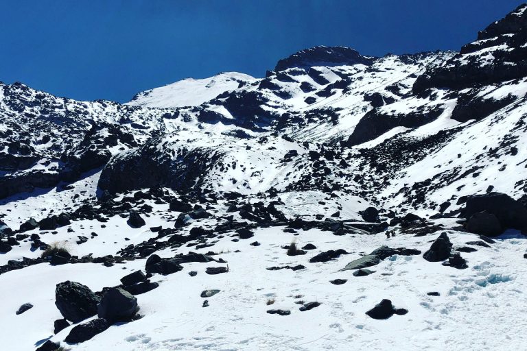
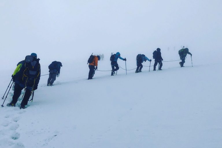
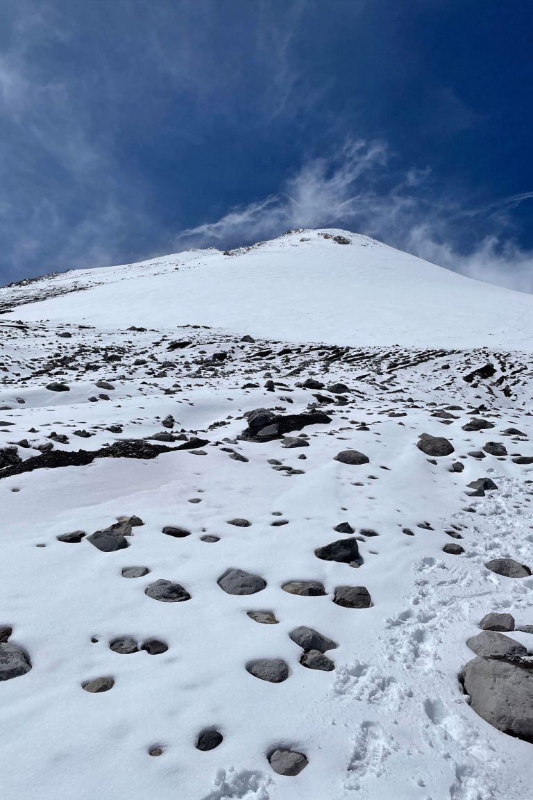
On summit day, we get up at midnight and, after breakfast, we start walking at one o'clock in the morning. We ascend progressively over the next few hours to a pass called El Brinco, where the Labyrinth begins, a series of chutes with varying degrees of difficulty.
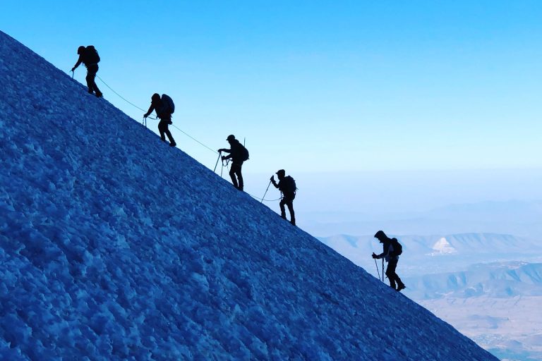
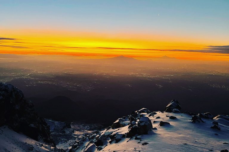
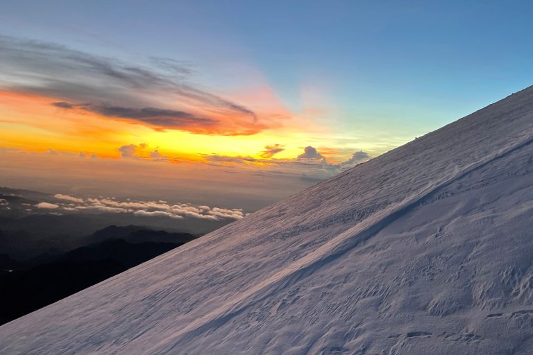
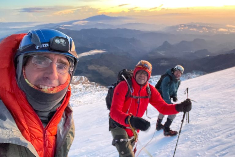
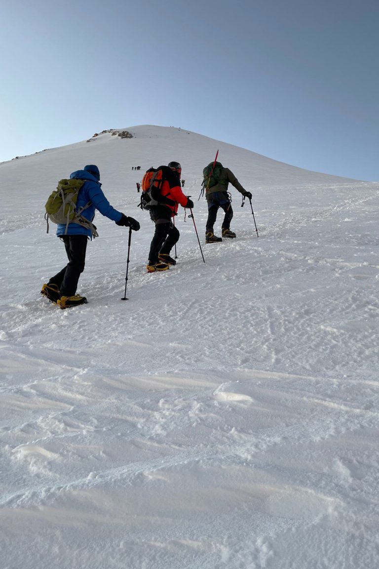
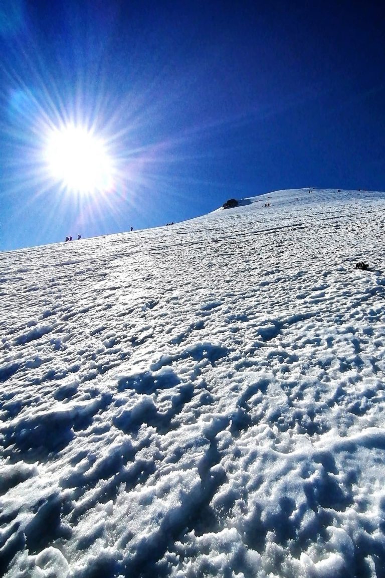
An hour and a half later we arrive at the base of the Jamapa Glacier. We hydrate, put on our crampons, rope up, and go on. An hour later the sun comes up. It is the coldest moment of the day, but the appearance of the sun to our right fills us with excitement and encouragement.
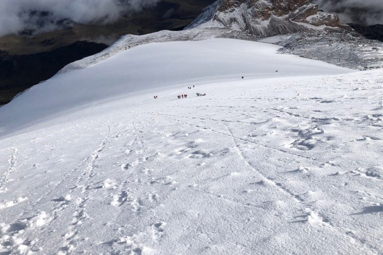
We progress in zigzag, with short breaks to drink and eat. About three hundred vertical meters above us rises the edge of the crater, which marks the top of the volcano.
Around eight o'clock we finally reach the spectacular crater, the size of a soccer stadium, which opens under our feet in a vertical drop of several hundred meters.
From the summit, on a clear day, we contemplate the Cofre de Perote to the north, and the unmistakable silhouettes of La Malinche, Popocatepetl and Iztaccihuatl to the west. It is an unforgettable view, and a well-deserved reward for our effort.
We begin our descent, and about four hours later we arrive at the Piedra Grande base camp, from where we start our return to our destination.
Equipment list
- Dryfit underwear
- Trekking boots or sports shoes and socks
- Warm pants and jacket (polartech type)
- Waterproof parka (Goretex or ski type)
- Down jacket or similar
- Thin gloves and thick gloves or mittens Woolen hat or balaclava and sun hat
- Hiking boots and wool socks
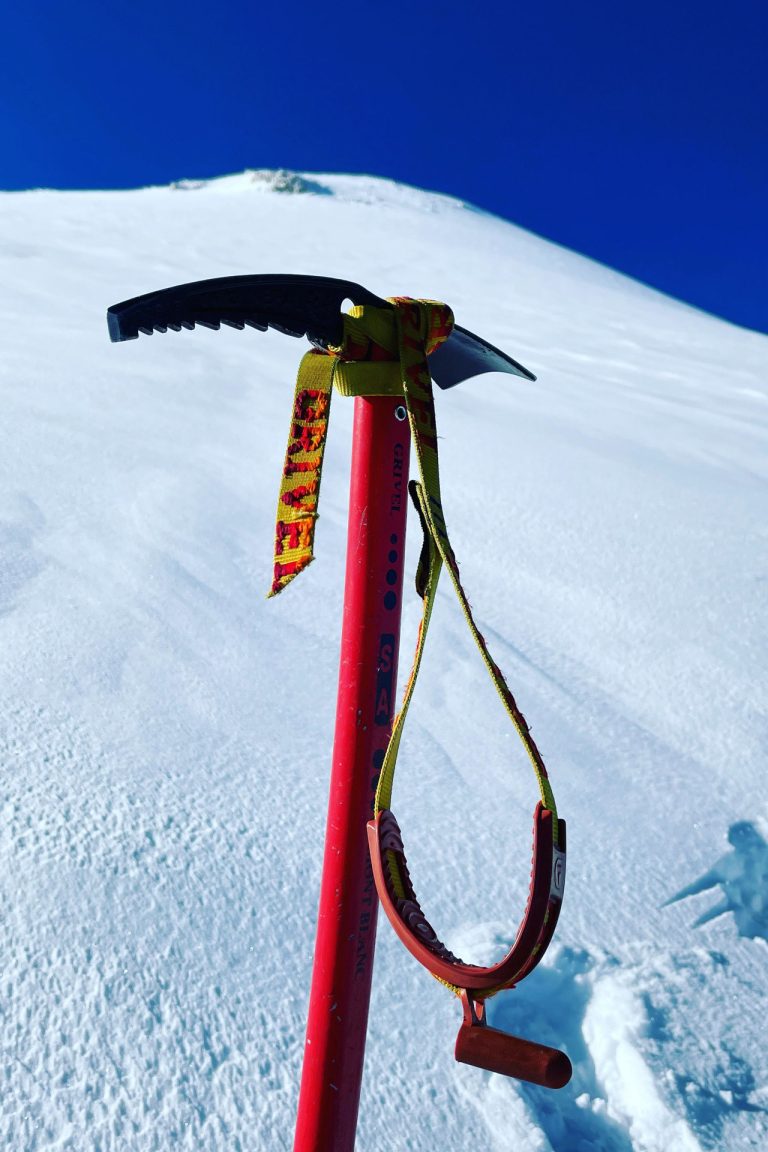
- Helmet and ice axe (provided by AdvenCulture)
- Harness and crampons (provided by AdvenCulture)
- Hiking poles (available for rent)
- Sun glasses
- Sun & lip screen
- Sleeping bag
- Head lamp
- Backpack (about 40 liters capacity)
- Nalgene type cylindrical bottles