Expedition to Pico de Orizaba North Face
- Duration: 2 or 3 days
- Altitude: 5,536 meters (18,490 feet)
- Vertical gain: 1,400 meters (4,594 feet)
- Total distance: 7 kilometers (4.34 miles)
- Total time: 12 hours (ascent 8, descent 4)
- Terrain: intermediate (use of crampons on the glacier)
- Five hours of aerobic exercise per week
- It is recommended to climb a four-thousander first
Description
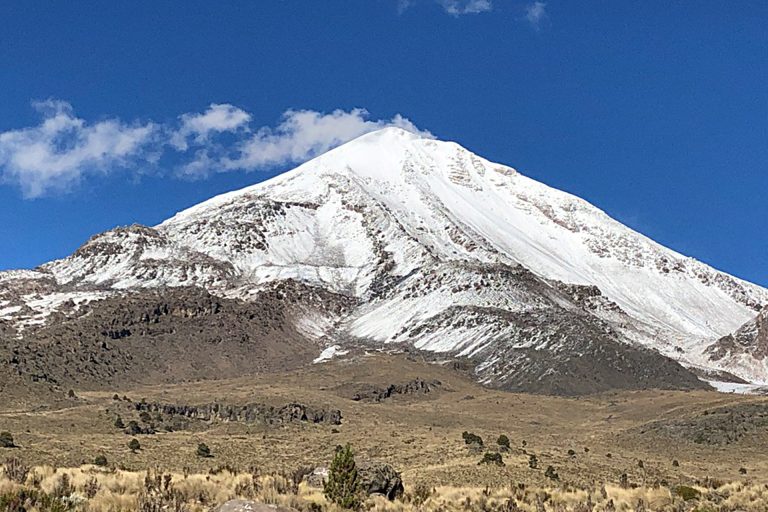
The Pico de Orizaba is also known as Citlaltépetl, or “Mountain of the Star” in náhuatl. With 5,636 meters (18,490 feet) it is Mexico’s tallest mountain, and the third highest in North America.
For this expedition we need to be in top physical condition, and conveniently acclimatized. The ascent takes between six and eight hours, the descent around four hours.
We often spend the previous day at La Malinche or the Nevado de Toluca. It is advisable, although not indispensable, to have experience in the use of crampons and ice-ax.
From Tlachichuca we drive up a dirt road to the Piedra Grande hut, at 4,200 meters. We then do a quiet, slow acclimatization walk to 4,500 meters, come back, and do the final equipment check. Around sundown, we have dinner and go to be early.
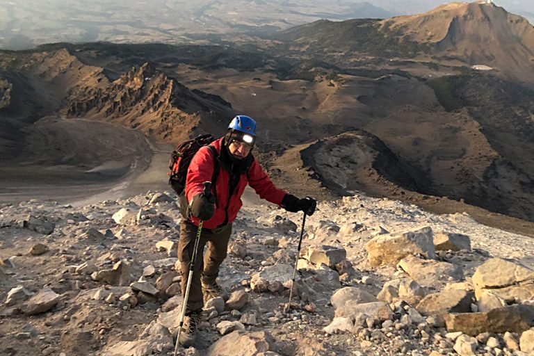
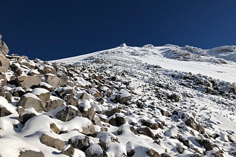
On summit day we rise at midnight, have breakfast and start climbing around one am. After a couple of hours we reach a pass called El Brinco (“The Jump”, where the famous Labyrinth begins. The inclination increases as we continue climbing up several couloirs.
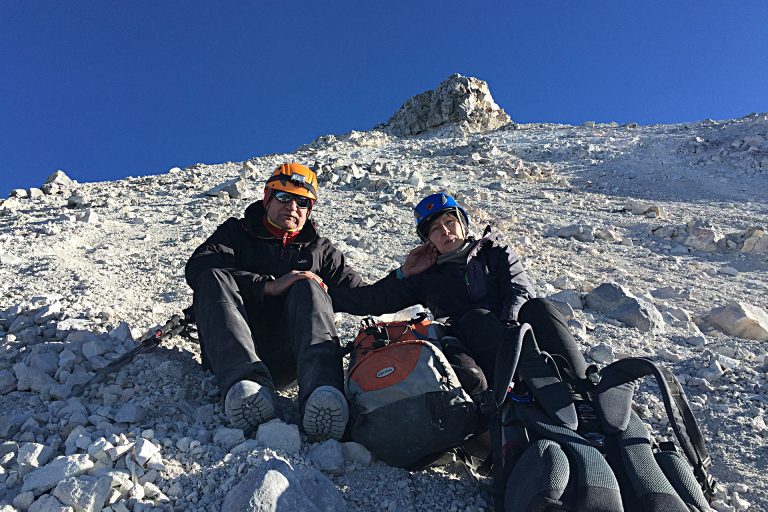
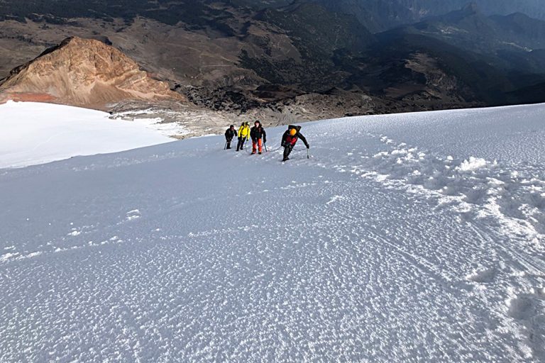
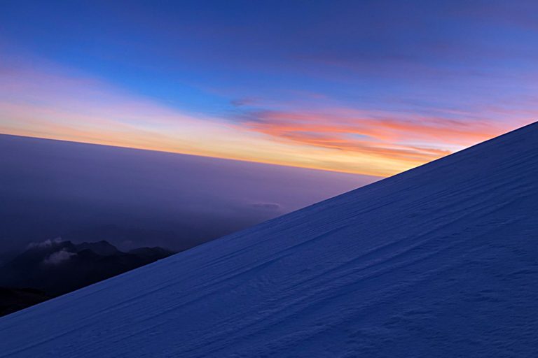
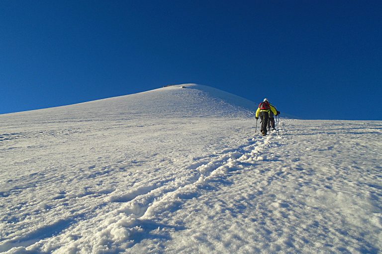
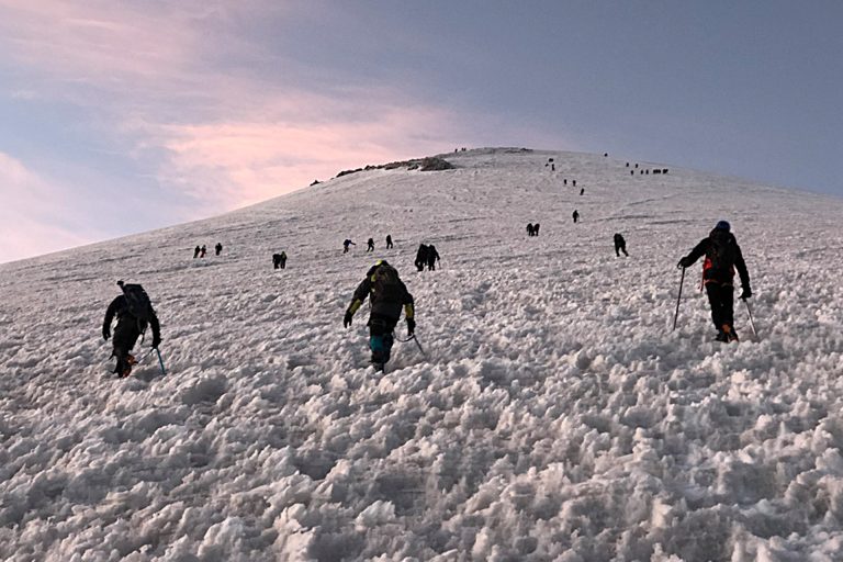
Ninety minutes later we reach the base of the Jamapa Glacier. Time for a break! We rest, drink, put on our crampons, rope up, and move forward! One hour later it starts dawning. It is the coldest moment of the climb, but the appearance of the sun fills us with motivation.
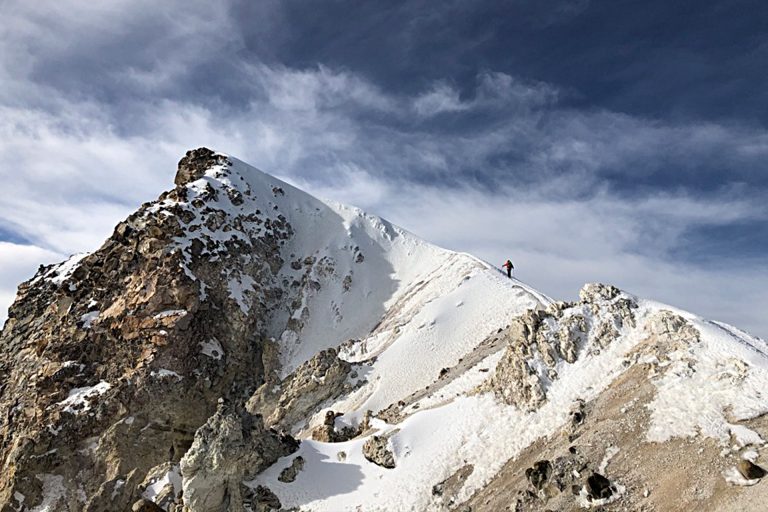
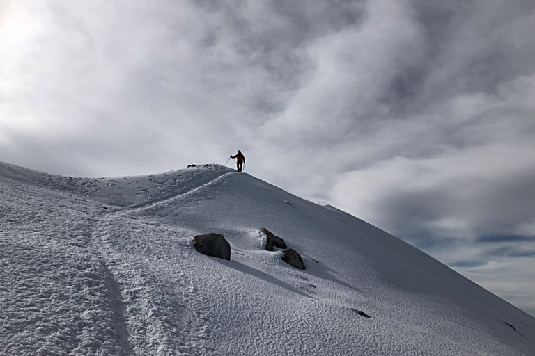
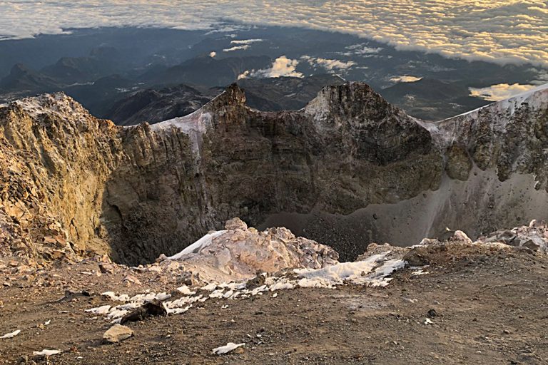
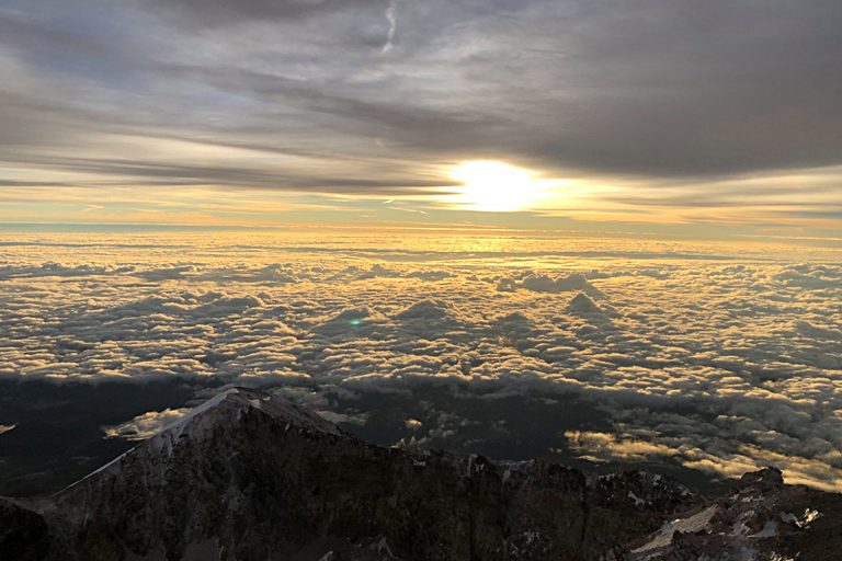
We now see, three hundred vertical meters above us, the rim of the crater, that signals the pre-summit of the volcano. We push forward, in zigzag pattern, with brief stops to eat and drink. Around eight o’clock we finally reach the rim of the crater, the size of a football stadium, and several hundred meters deep. We still have thirty more minutes to go to the highest point of the Pico.
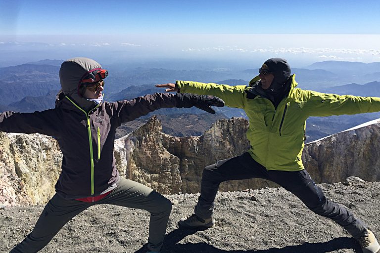
From the summit, on a clear day, we contemplate the Cofre del Perote to the north, and the unmistakable silhouettes of the La Malinche, Popocatépetl and Iztaccíhuatl to the west. It is an unforgettable view.
Between three and four hours later we reach the Piedra Grande hut, and begin our trip back to the civilization.
5,000 Equipement List
- Dryfit underwear
- Trekking boots or sports shoes and socks
- Warm pants and jacket (polartech type)
- Waterproof parka (Goretex or ski type)
- Down jacket or similar
- Thin gloves and thick gloves or mittens Woolen hat or balaclava and sun hat
- Hiking boots and wool socks
- Helmet (provided by AdvenCulture)
- Harness, crampons and ice-ax (provided by AdvenCulture)
- Hiking poles (available for rent)
- Sun glasses
- Sun & lip screen
- Sleeping bag
- Head lamp
- Medium-size backpack (50 l)
- Snacks and 2-3 liters of water
Expedition to Pico de Orizaba South Face
- Duration: 2 or 3 days
- Altitude: 5,536 meters (18,490 feet)
- Vertical gain: 950 meters (3,116 feet)
- Total distance: 8 kilometers (2.5 miles)
- Total time: 8 hours (ascent 6, descent 2)
- Terrain: Easy
- Five hours of aerobic exercise per week
- It is recommended to climb a four-thousander first
Description
The Pico de Orizaba is also known as Citlaltépetl, or “Mountain of the Star” in náhuatl. With 5,636 meters (18,490 feet) it is Mexico’s tallest mountain, and the third highest in North America.
For this expedition we need to be in top physical condition, and conveniently acclimatized. The ascent takes between five and six hours, the descent only two hours (one of the greatest advantages of this route!).
From Atzinzintla we drive to the Valley of the Gathering a quiet forest at about 4,000 meters, where we pitch our tents. That afternoon we take a quiet walk to 4,500 meters. As it is customary, we enjoy an early dinner, do a final equipment check, and go to bed at dusk
On summit day we rise at midnight, have breakfast and hop on our 4x4 vehicle, which takes us to an altitude of 4,600 meters (pity, the road just ends there!). We start walking, and thirty minutes later reach the Fausto González hut, at 4,700 meters.
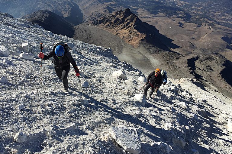
We begin climbing on a soft terrain, and come to a ridge called El Espinazo, (The Backbone), which we follow during the next three hours. We reach a point appropriately named El Arrepentimiento (The Repentance), take a break, hydrate ourselves, and go on.
It starts dawning, the coldest moment of the night. We come to a scree slope. A hundred vertical meters above us we see a rock formation called The Pulpit. We now wear our crampons, take a deep breath and carry on.
Around eight o’clock we finally reach the summit. On a clear day, we contemplate the Cofre del Perote to the north, and the unmistakable silhouettes of the La Malinche, Popocatépetl and Iztaccíhuatl to the west. It is an unforgettable view.
The descent is done following a long scree slope, which saves us plenty of time and energy.
5,000 Equipement List
- Dryfit underwear
- Trekking boots or sports shoes and socks
- Warm pants and jacket (polartech type)
- Waterproof parka (Goretex or ski type)
- Down jacket or similar
- Thin gloves and thick gloves or mittens Woolen hat or balaclava and sun hat
- Hiking boots and wool socks
- Helmet (provided by AdvenCulture)
- Harness, crampons and ice-ax (provided by AdvenCulture)
- Hiking poles (available for rent)
- Sun glasses
- Sun & lip screen
- Sleeping bag
- Head lamp
- Medium-size backpack (50 l)
- Snacks and 2-3 liters of water